效果
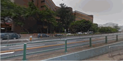
Google街景小车开启了地图与现实结合的大门,也让我们可以利用 Google Maps 浏览全世界的美丽风光。街景车采集的数据简单来说就是加了经纬度的图片,我们也可以利用这些图片来制作街景小动画,上香港示例(大陆没有Google 街景数据):
Coding
使用 Direction API 进行两地间导航,利用 Street View API 将街景图片预加载,使用了 Hyperlaps.js,Hyperlapse.js依赖 GSVPano 和 three 两个 js 库。
1 2 3 4 5 6 7 8 9 10 11 12 13 14 15 16 17 18 19 20 21 22 23 24 25 26 27 28 29 30 31 32 33 34 35 36 37 38 39 40 41 42 43 44 45 46 47 48 49 50 51 52 53 54 55 56 57 58 59 60 61 62 63
| <!DOCTYPE html> <html> <head> <title>Simple Example</title> <script src="https://maps.googleapis.com/maps/api/js?v=3.exp" type="text/javascript"></script> <script src="js/three.min.js"></script> <script src="js/GSVPano.js"></script> <script src="js/Hyperlapse.js"></script> <script> function init() { var hyperlapse = new Hyperlapse(document.getElementById('pano'), { lookat: new google.maps.LatLng(37.81409525128964,-122.4775045005249), zoom: 1, use_lookat: true, elevation: 50 }); hyperlapse.onError = function(e) { console.log(e); }; hyperlapse.onRouteComplete = function(e) { hyperlapse.load(); }; hyperlapse.onLoadComplete = function(e) { hyperlapse.play(); }; var directions_service = new google.maps.DirectionsService(); var route = { request:{ origin: new google.maps.LatLng(22.2962259,114.1724561), destination: new google.maps.LatLng(22.3025739,114.1720511), travelMode: google.maps.DirectionsTravelMode.DRIVING } }; directions_service.route(route.request, function(response, status) { if (status == google.maps.DirectionsStatus.OK) { hyperlapse.generate( {route:response} ); } else { console.log(status); } }); } window.onload = init; </script> </head> <body> <div id="pano"></div> </body> </html>
|
Git 仓库
https://github.com/alphayang/hongkong_fast_street_view
更多
新车试驾,旅游规则,展览。。。
Tips
加载 maps api 需科学上网,加载图片时间视需下载街景图片数据而不同,由于是全部下载完成再开始播放,需要些耐心。
由于国内 google maps api 还没有街景资源,此处不能用使用国内http://www.google.cn/maps/api/js